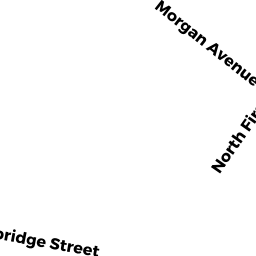
183-185 CAMBRIDGE ST
Owner Information
CAMBRIDGE CITY OF
491 BROADWAY
CAMBRIDGE, MA 02138


Property Details
183-185 CAMBRIDGE ST is classified as a Improved, Municipal Public Safety (Firehouse).
The primary structure on this property was built in 1980. There are 14,780ft2 of built area within this property. There is 14,780ft2 of residential/living space within this property.
183-185 CAMBRIDGE ST is valued at $5,354,300. The land is valued at $2,277,900 and the structures are valued at $3,076,400.
This property is in Zone BA. Confirm with local Zoning Board authorities to ensure there are no overlays or other easements on this property.
The most recent deed for 183-185 CAMBRIDGE ST is recorded at the local registrar in Book 0000, Page 0000. 183-185 CAMBRIDGE ST was last sold on Monday, January 1, 1900 for $0.
Assessment data from fiscal year 2021.
Flood Data
According to the FEMA National Flood Hazard Layer, this property does not appear to be in a flood zone. It may also be in an area not yet reviewed. Nonetheless, confirm this information prior to taking any action.
To view the flood hazards around this property, create a FEMA "Firmette" Map of the area around 183-185 CAMBRIDGE ST.
Broadband Internet Providers
| Provider | Type | Bandwidth (mbps) | |
|---|---|---|---|
| MCI | Copper Wire | 0 | 0 |
| VSAT Systems, LLC. | Satellite | 2 | 1 |
| Crown Castle Fiber | Fiber | 0 | 0 |
| HughesNet | Satellite | 25 | 3 |
| GCI Communication Corp. | Satellite | 0 | 0 |
| netBlazr Inc | Fixed Wireless | 50 | 50 |
| Starry, Inc. | Fixed Wireless | 200 | 200 |
| Comcast | Cable | 1000 | 35 |
| Verizon New England Inc. | DSL | 7 | 0 |
| Viasat Inc | Satellite | 100 | 3 |
Broadband service provider data from December 2020.
Adjacent Properties
- 227 CAMBRIDGE ST
Small Retail and Services stores (under 10,000 sq. ft.) owned by YONEDA PROPERTIES II MASSACHUSETTS, LLC - 203 CAMBRIDGE ST
General Office Buildings owned by 189 CAMBRIDGE STREET, LLC - 38 GORE ST
Single Family Residential owned by DATTERO, AGNES M. - 38.5 GORE ST
Single Family Residential owned by DATTERO, AGNES M.